
Construction Progress Documentation
Track the project from a consistent aerial perspective.
Elevated Drone Services provides organized aerial photography and video for construction projects, helping owners, contractors, project teams, and stakeholders review visible progress, communicate updates, and maintain a dated visual record.
- FAA Part 107 certified
- One-time or recurring site documentation
- Organized stakeholder-ready deliverables
Pricing is customized based on site size, project duration, documentation frequency, requested viewpoints, photography or video, reporting needs, travel, airspace, and site complexity.
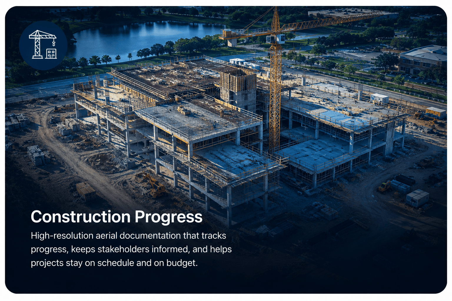
A broader view of what is changing
Aerial documentation creates a dated visual record of observable site conditions and visible project progress from perspectives that can be difficult to obtain from ground level. Imagery does not verify contract completion, schedule compliance, workmanship, quantities, code compliance, safety compliance, structural condition, or payment eligibility.
Documentation for active projects and visible milestones
Feasibility depends on airspace, site access, crane activity, equipment, workers, obstructions, weather, safety requirements, and coordination with site management.
One-time and recurring coverage
Milestone Documentation
One-time flights can document major phases such as initial conditions, site preparation, structural progress, roof installation, exterior completion, or final visible conditions.
Recurring Progress Documentation
Weekly, monthly, phase-based, or customized visits can create a more organized visual timeline using similar viewpoints when conditions permit.
Consistent planning and organized delivery make it easier to compare visible changes across the life of the project.
Photography and video options
Progress Photography
High-resolution aerial photographs can document site layout, building progress, roof and exterior work, equipment staging, access routes, and visible changes.
Progress Video
Smooth aerial video clips can provide broader project context for stakeholder updates, presentations, internal communication, and approved marketing uses.
Documentation can include photography, video, or a customized combination based on project goals. Live streaming, real-time monitoring, 3D models, orthomosaics, measurements, mapping, and surveying are not presented as standard services.
Planned viewpoints and site coverage
- Elevated site overview
- Multiple building angles
- Top-down overview when appropriate
- Roof and exterior progress
- Access roads and staging areas
- Sitework and visible drainage features
- Material and equipment areas visible from the air
- Major completed phases
- Similar comparison viewpoints across visits
- Final visible project overview
Actual coverage depends on the agreed scope and safe operating conditions.
Construction sites change continuously. Cranes, workers, equipment, temporary structures, access restrictions, and active operations may require flight paths or viewpoints to be adjusted between visits.
How the project works
01
Define the documentation plan
Review the project location, schedule, stakeholders, desired viewpoints, visit frequency, milestones, and requested deliverables.
02
Coordinate with the site
Confirm site contact, access, airspace, active operations, crane activity, worker locations, obstructions, weather, and safe operating areas.
03
Capture visible progress
Collect approved aerial photographs and video from planned perspectives within the agreed project scope.
04
Organize and deliver
Prepare dated files, selected comparisons, observations, or reporting materials for straightforward review and sharing.
Scheduling and delivery timing will be confirmed with the quote and may require coordination with active site operations.
Possible deliverables
- Dated high-resolution aerial photographs
- Site overview images
- Planned comparison viewpoints
- Before-and-after layouts
- Selected aerial video clips
- Short edited progress videos
- Milestone image collections
- Annotated areas of interest when requested
- Downloadable progress PDF options
- Organized digital delivery
- Files prepared for owner, contractor, or stakeholder review
- Approved marketing and portfolio imagery when included
The documentation plan, naming structure, visit schedule, image selection, reporting format, and intended usage should be agreed before recurring work begins.
Built around the realities of an active jobsite
Safety and legal operating requirements take priority over any requested photograph, video clip, angle, or schedule.
- Designated site contact
- Approved access and operating area
- Worker and equipment awareness
- Crane and lift coordination
- Flight timing around active operations
- Airspace and location review
- Weather and wind monitoring
- Clear communication before each visit
- Adjustments when site conditions change
Extend the record beyond active construction
After construction, recurring property, roof, or thermal documentation can help maintain an organized visual history when appropriate.
Service area
Elevated Drone Services provides construction progress documentation across Central Florida, including Orange, Seminole, Volusia, Lake, and Brevard counties.
Every project is subject to airspace, site permission, active operations, weather, travel, access, and safe flight conditions.
Frequently asked questions
How often can a construction site be documented?
Visits can be one-time, weekly, monthly, milestone-based, or customized depending on project needs, site access, safety, weather, and availability.
Can each visit use the same viewpoints?
Similar planned viewpoints can support comparison, but exact duplication is not guaranteed because construction sites, access, obstructions, cranes, equipment, and flight conditions change.
Does aerial documentation verify construction quality or completion?
No. It records observable conditions from the agreed aerial perspectives and does not certify workmanship, completion percentage, schedule compliance, code compliance, quantities, structural condition, or payment eligibility.
Can the imagery be shared with owners and stakeholders?
Yes, according to the agreed delivery and usage terms. Files can be organized for straightforward review and communication.
Can progress video be used for marketing?
Approved marketing or portfolio deliverables can be included when requested and when the client has the necessary permissions.
How is the service priced?
Quotes depend on site size, project duration, visit frequency, flight complexity, requested photography or video, reporting, travel, airspace, and site conditions.
Build a visual record from the ground up.
Aerial construction documentation records observable site conditions within the agreed project scope. It is not a survey, engineering evaluation, safety inspection, code inspection, certification of workmanship, verification of quantities, or confirmation of project completion.