
Aerial Real Estate Media
Show the property from a perspective buyers remember.
Elevated Drone Services creates polished aerial photography and video that helps real estate professionals present the property, surrounding features, location, and overall scale with greater visual impact.
- FAA Part 107 certified
- High-resolution aerial photography
- Edited photo and video options
Pricing is customized based on property size, location, requested photos or video, editing needs, travel, airspace, and project complexity.
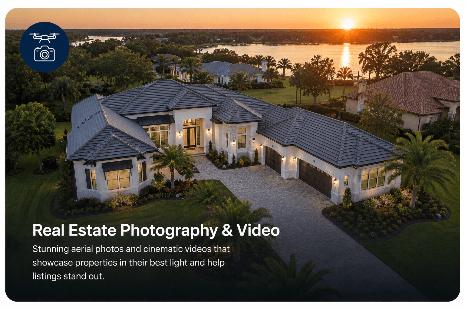
Give buyers a clearer sense of place
Aerial media can help viewers understand the property’s layout, scale, surrounding area, access, outdoor features, and relationship to nearby amenities. It does not guarantee a faster sale, a higher sale price, more showings, or any specific marketing result.
Aerial media for a range of property listings
This service focuses on aerial photography and video. Interior photography, virtual staging, floor plans, 3D tours, and ground-based photography are not included unless specifically added to a future quote.
Photography and video options
Aerial Photography
High-resolution edited aerial images can show multiple angles, property features, approach views, surrounding context, and overall scale.
Aerial Video
Smooth aerial clips can provide a more immersive view of the property and can be prepared for listing presentations, websites, promotional use, or social media based on the agreed scope.
The project can be customized around still photography, aerial video, or a coordinated combination of both.
Possible shot coverage
- Front approach and elevated exterior views
- Multiple property angles
- Top-down property overview
- Outdoor features and landscaping
- Driveway and access views
- Nearby surroundings when relevant
- Commercial frontage and visibility
- Land, acreage, and site context
- Smooth aerial reveal and orbit-style video clips when safe and appropriate
Actual coverage depends on property layout, vegetation, obstructions, nearby people, airspace, weather, safety, and the agreed project scope.
How the project works
01
Share the listing goals
Review the property, audience, desired angles, important features, timeline, and requested photo or video deliverables.
02
Plan the flight
Confirm airspace, weather, property access, safe operating areas, sun position, surroundings, and any scheduling considerations.
03
Capture the property
Collect aerial photographs and video clips from useful perspectives while operating within the agreed project scope.
04
Edit and deliver
Prepare the selected images or video files in an organized digital format ready for the approved marketing uses.
Expected scheduling and delivery timing will be confirmed with the quote.
Possible deliverables
- High-resolution edited aerial photographs
- Web-ready image files
- Aerial property overview images
- Short edited aerial video
- Selected individual video clips
- Horizontal marketing video options
- Vertical social-media video options when requested
- Organized digital delivery
- Branded or unbranded export needs discussed during quoting
- Custom deliverable combinations
Final file formats, dimensions, branding, usage, and delivery requirements should be confirmed before the flight so the media is prepared for its intended destination.
A little preparation makes the aerial media stronger
- Complete exterior cleanup when possible
- Move vehicles that block important views
- Store trash containers, hoses, and loose items
- Confirm gates and access
- Schedule landscaping before the flight when practical
- Turn on appropriate exterior or pool features when desired
- Tell occupants and on-site personnel about the flight
- Identify the most important selling features in advance
People should not be positioned beneath or unnecessarily close to the flight area.
Need a property record instead of listing media?
Marketing media is designed to present a property attractively, while commercial property documentation is organized to create a condition record for owners, managers, contractors, and facility teams.
Service area
Elevated Drone Services provides aerial real estate photography and video across Central Florida, including Orange, Seminole, Volusia, Lake, and Brevard counties.
Every project is subject to airspace authorization, weather, safe operating conditions, property access, and location suitability.
Frequently asked questions
What types of real estate can be photographed?
Residential, commercial, multifamily, large-lot, land, and selected rental properties may be suitable depending on airspace, location, safety, and project scope.
Do you provide interior photography?
This service page focuses on aerial photography and video. Any additional ground-based or interior media would need to be discussed and specifically included in the quote.
Can aerial video be created for social media?
Vertical or horizontal formats can be discussed during quoting so the project is captured and edited for the intended platform.
Can you show property boundary lines?
Any boundary graphic would be approximate marketing information based on client-provided material and would not be a legal boundary survey. This is not a standard deliverable.
What happens if the weather is unsuitable?
Flight timing may need to be adjusted for rain, strong wind, poor visibility, unsafe conditions, or unsuitable lighting.
How is the service priced?
Quotes are customized based on property size, location, travel, airspace, requested photography or video, editing, file requirements, and project complexity.
Give the listing a stronger aerial perspective.
Aerial media is subject to airspace requirements, weather, property access, privacy considerations, and safe flight conditions. Marketing results are not guaranteed.